20 Best Tips

Antarctica Geography Printables – Free Printables

Antarctica mini unit study

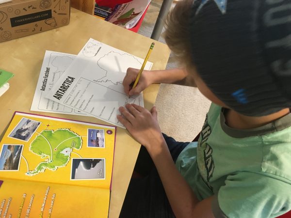
Our recent geography study has taken us to Antarctica and that involved some more updated printables for Kaleb. While Antarctica isn’t a country and doesn’t have a government per se, these were helpful to us in our learning. Below too you will find additional helps for learning tools, lesson plans, and a book unit from other moms to help you out as well. 
Antarctica homeschool printables

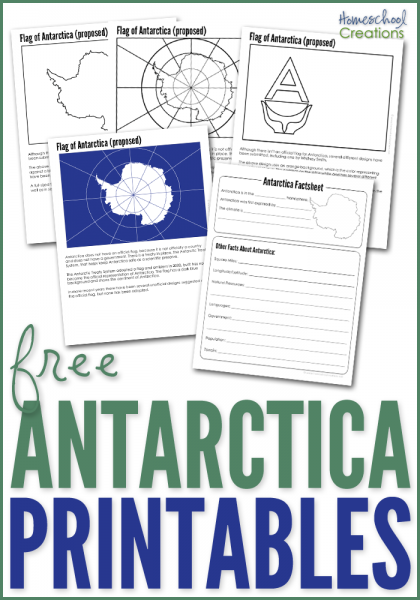
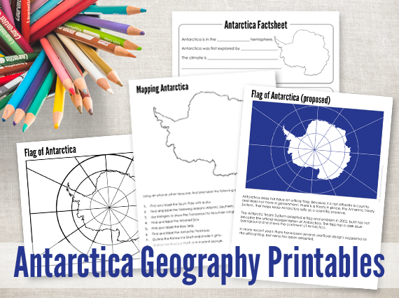
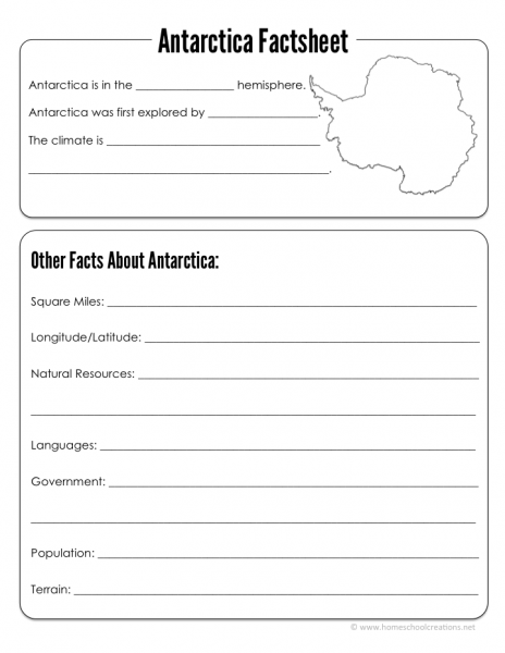
The Antarctica Geography Printables include the following worksheets:

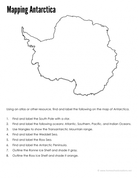
  • an Antarctica mapping sheet {map mountains, oceans, ice shelves, science station, and other geographical information}
  • an Antarctica factsheet to write down information about Antarctica including current population, climate, type of government, and more.
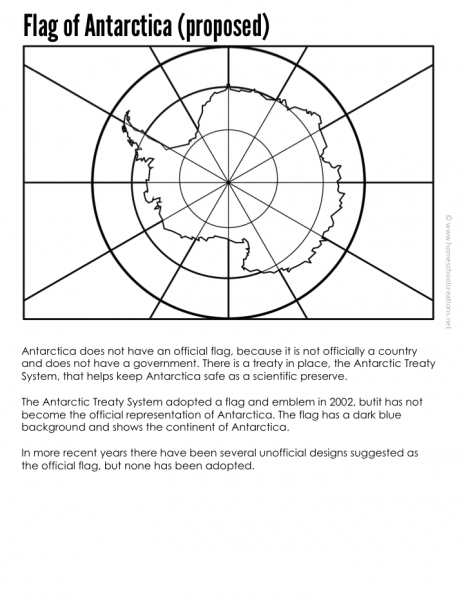
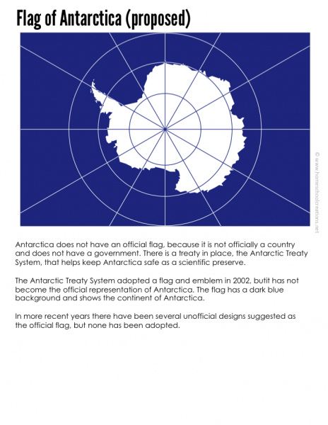
  • an Antarctica flag coloring page (both unofficial and proposed)
  • an Antarctica flag information sheet and notebooking page
Slide10  Slide04
Slide07   Slide02

Download button
 
Antarctica geography printables from Homeschool Creations_edited-1

We’ve been using the below books to help us fill in the information blanks with our pages: 


Here are a few helpful sites to look at in your Antarctica studies:

More Geography Resources

continent-fact-files-and-flash-cards-from-homeschool-creations_edited-1

FREE Continent Fact Files

Don’t miss these FREE geography printables listed by continent…
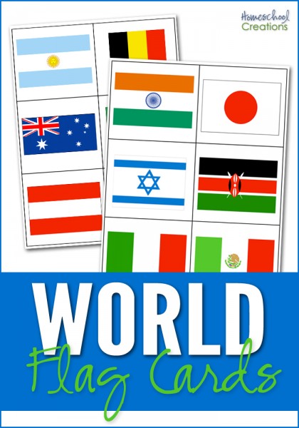
world flag cards for matching free homeschool geography resources 10 tools for teaching geography - hands on ways to incorporate geography learning

Click on one of the globes below to search for geography resources by continent. Each page has downloads for flag coloring and information pages, mapping pages, and links to blog post full of lesson plans and additional information.
Africa   Asia   Australia
Europe    North America    South America
 

We also highly recommend taking part in a Little Passports subscription! Not sure which adventure to choose for your explorer? Check out these Little Passports website for more information. 

Continents Fact Files Printable – Geography Printables

continent-fact-files-and-flash-cards-from-homeschool-creations_edited-1 

This year Kaleb and I have been wandering around the world via books, Little Passports, and various other things we come across in our travels. We have a slew of resources and to go along with a few of our books, I put together some printables where we could track important information related to the countries. 

continent-fact-files-printables-from-homeschool-creations_edited-1


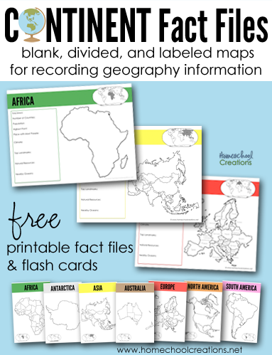
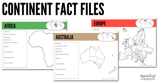
There are several pages for each continent: a blank continent image, one showing countries/territories within the continent, and another labeling each of the countries/territories within the continent (Antarctica only has one page). 

All continent fact pages were designed using the traditional Montessori colors: Africa (green), Antarctica (white), Asia (yellow), Australia (brown), Europe (red), North America (orange),  and South America (pink). 

Each page has room to record the following information and also shows where that continent is in comparison to other continents: 

  • Size/Area
  • Number of Countries
  • Population
  • Highest Point
  • Place with Most People
  • Climate
  • Top Landmarks
  • Natural Resources
  • Nearby Oceans

We’ve been using the below books to help us fill in the information blanks on each continent fact file: 


simple-continent-cards-from-homeschool-creations

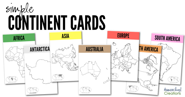
The set also has seven half-sheet printables we recommend printing off onto cardstock and laminating. Use them as larger flash cards to show the various country/territory divisions on the continents. We have a copy in each of our continent boxes and will put them on the wall above our map when we are studying the continent. 


We also highly recommend taking part in a Little Passports subscription! Not sure which adventure to choose for your explorer? Check out these Little Passports blog posts and learn more about their four subscription options:

Download the Continent Fact Files & Continent Cards

Your family is more than welcome to download the 23 page Continent Fact Files as well – and we hope they are a help to you!

 Download button


More Geography Resources


world flag cards for matching free homeschool geography resources 10 tools for teaching geography - hands on ways to incorporate geography learning

Click on one of the globe to search for geography resources by continent. Each page has downloads for flag coloring and information pages, mapping pages, and links to blog post full of lesson plans and additional information.
 

Africa   Asia   Australia
Europe    North America    South America


10 Tools for Teaching Geography & Exploring the World

10 tools for teaching geography - hands on ways to incorporate geography learning

We are barely finished with this school year, and over the last few weeks (ok, months) I’ve been piecing together what we will be doing during the upcoming school year. One of my initial plans for this past year was to work on world geography with the boys. Unfortunately, I went a little overboard in my mind and it was put to the side – mainly because I wanted to reinvent the wheel and put together a billion ideas (which were all good) into creating our own curriculum. 


Rather than running myself ragged – and truthfully in an effort to keep it more simple – I’ve decided to use something that is already pre-planned – Elementary Geography and Cultures from Masterbooks. It’s a curriculum I’ve been eyeing for quite some time (thanks to my friend Carisa) and includes the books Passport to the World and the Children’s Atlas of God’s World .  Yes, I will likely end up reworking some of my past geography printables and also create a few additional go-alongs for what we are doing, BUT I am so very excited about this one year world geography plan. 

Now, while having a curriculum framework to follow is great, the most effective way to teach our kids geography is through the hands-on tools that go along with ANY curriculum. Here are 10 tools for teaching geography – all things our family has used (and will use again) to keep learning fun.

10 Tools for Teaching Geography

10 tools for teaching geography and exploring the world

1 // Read Lots of Literature (and then some more)

One of the things we enjoyed the most our first geography go-round were the many books that are available based on the countries we studied. From missionaries that served in the country to picture books about artists or scientists, there is an amazing abundance of books to read and learn through. If you’d like to see the books we read through before, check out this page and click on the continent link to see favorites by country. 

2 // Play and Learn Music

Music can be one of the best tools to use for children to memorize things. Our girls used Geography Songs and we’ll use that again for learning countries, bodies of water, and continents.

Also spend time listening to composers who were born in the different countries or music that is native to the geographical areas. Take a trip to your library and check out a few CDs or have fun browsing YouTube to see traditional dances. 

3 // Create Art

Amazon Animal Chalk Pastel-17

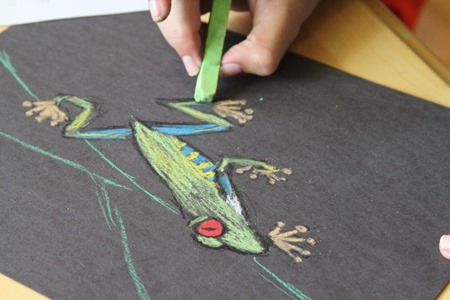
Learn about artists native to the country you are studying or special art styles that are based in a geographical region.  When we were studying the Amazon, we used chalk pastels to draw frogs, toucans, and other animals from the rainforest. They were some of our favorite drawings we’ve done! 

4 // Create Continent Boxes

Put aside and group all of the hands-on materials you collect into boxes (or bags) based on countries or continents. Over the years we’ve collected many fun things (some from our subscription to Little Passports) and also some new materials (I am absolutely in love with TOOBS and their animals and landmark figures). I’ve purchased seven photo storage boxes to keep all our materials in one spot. (Thanks to Counting Coconuts for the idea.)

5 // Learn about the Animals

Include a little science learning into each geographical area you study by looking at animals that are native to to that country. Our girls loved learning about kangaroos and koalas when we studies Australia, peacocks when we learned about India – and there are so many more. Learn about their habits, diet, and classification. We often created lapbooks and those stayed on our shelves to review for years to come.

6 // Eat and Cook a Special Meal Together


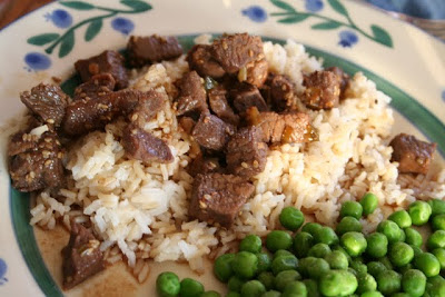
Cooking is not only a life skill for kids to learn, but it can be a memorable way to learn about a country. Depending on the country you are studying, pick a recipe or create a meal that would be native to that country (granted Antarctica might be a little hard…), but snow cones might be a favorite! Every now and then we would treat the kids to a special meal out if we had a great restaurant in town, because sometimes the cultural experience is equally (or even more) fun. If Pinterest is too overwhelming, the book Eat Your Way Around the World is full of recipes to try.


7 // Put a Puzzle Together

While you are reading out loud or keeping fidgeting kids busy, pull out a puzzle and work on it together. We have all of the GeoPuzzles and absolutely LOVE them. Rather than being regular shaped puzzle pieces, each piece is shaped like the countries within that continent. 

8 // Make Lego Creations

Using Legos in the Classroom

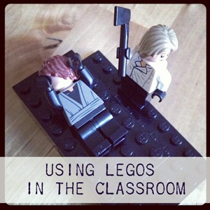
Legos may never leave our home. Our kids have a plethora of them, and we will definitely be incorporating them into our geography time filling out blank outline maps, building famous landmarks…or getting a good laugh in when the kids depict the most hilarious historical scenes with LEGOs. (Sometimes you just have to laugh even though beheading are no laughing matter.)

9 // Draw Through the Countries

Have a child that loves to draw? Pull out the Draw Write Now series and let your kids illustrate their way around the world. Use the Draw and Journal pages to draw a picture of an animal or landmark in that country and write down a few facts to go along. Our kids love to draw while I’m teaching – and it can help them remember facts better as well. Geography Through Art is another great book that includes art projects using different mediums – from all around the world.  

10 // Use Geography Printables

free geography resources

If you know me well, you’ll know that I love creating printables that help our kids in the learning process. Over the years we have used a variety of printables, both ones I’ve pulled together and ones from other blogging friends. Here are a few free geography resources


Those are a few of the ways we incorporate fun into our geography studies – how has your family expanded geography learning together? 


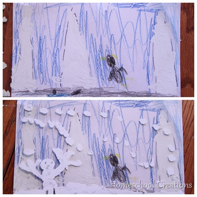
White-Out Snow Craft

Snow-scene-craft-using-white-out.jpg

All of our kids had a great time working on this craft ~ especially Kaleb. Actually, Kaleb had way too much fun. By fun, I mean that Kaleb was painting his face with the white-out brush, painting the table, took a lick of white-out, and then dropped it on the floor.  Now I’m trying to figure out how to get white-out off my wood floor.

IMG_2967

BUT the end result was much better than the actual process, so maybe MY misfortune can help you all find a better process. :)

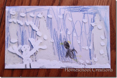
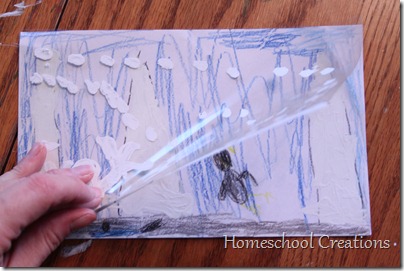
The project is actually two layers ~ a transparency sheet lays over top of a picture that your child has colored. Then you add ‘snow’ to the picture by painting on the transparency layer.

IMG_2969

What You’ll Need:

  • a jar of white-out
  • white paper
  • clear tape
  • colored pencils
  • transparency sheets
  • scissors or paper cutter

How to Make Your Snow Scene:

Our pictures were a half sheet of paper {5 1/2” x 8 1/2”}.

  • Cut your sheet of paper and overhead transparency sheet in half so that they are the above size. You can use a full sheet if you want to also.
  • Tape the transparency sheet to the top of the paper on one of the sides, so that you can open it like a book.
  • Have your child color a scene/picture on the paper using colored pencils or crayons.
  • Flip the transparency over top of the picture and let your child add snow to the picture scene.

Here is how Zachary’s picture looked with and without his snow.

White Out Painting

Antarctica: Learning about Shackleton

I’d love to say that I single-handedly came up with the lesson plans for our final week in Antarctica, but since I found some that were amazing, I have to share them!

We found the movie Shackleton’s Antarctic Adventure through Netflix and we watched it several times. I even cried watching it! The story is absolutely amazing, and if you haven’t heard about it, this is one that you should really check out! You can see a trailer of the film here.

The lesson plans that I found go along with the movie and provide a HUGE resource for teachers and students to follow along and learn more about Shackleton. You can access the full set of plans here and there is also a family movie guide too.

Using the guide, here’s how our week looked:

Monday – We watched the movie together after working on some of our general schoolwork. We also spent a little time on the NOVA online site looking at virtual 360 pictures of various places in Antarctica.

Tuesday – We tracked Shackleton’s expedition using latitude and longitude and the timeline that was provided. We followed along mapping where he first started out, where his ship got stuck and crushed, where the crew was stranded, and eventually where the crew was rescued.

I have to say that McKenna absolutely amazed me during this activity. She was mapping points so quickly and accurately! Have to say that I was rather impressed. :)

Wednesday – We did another journaling activity called “In Your Own Words”. First, we read through different journal entries from Shackleton and his crew. When we were done reading through those entries, we created some of our own entries journaling our day.

Thursday – We did an activity called “What’s on Your Plate?” comparing the things that we ate during our day and what a typical day for Shackleton’s crew might have been. We figured up caloric values and also talked about the differences between carbohydrates, proteins, and/or fat.

Here are some other great resources on Shackleton also:

Hope these resouces help you all out! Can’t tell you how much we’ve enjoyed spending time in Antarctica!

Antarctica ::Week 2::

We continued on our journey to the bottom of the Earth this past week – all of us absorbing MUCH more information and having a great time exploring a continent that we didn’t think would be all that exciting! Just today (Sunday) I found some more great links and asked the girls what they would like to do next week and had a very loud: MORE SHACKLETON!! So we’ll be spending a few more days in Antarctica it seems and then moving on to a unit study on penguins for the oldest three.

I will be sharing a ton of the great links that we’ve been using this last week at the end of the post, so be sure to check them out. It is by no means a complete collection, but there are guaranteed to be some great helps for you in the list.

Here’s a look into how our week worked out:

Monday

  • Reviewed some of our studies from last week (Antarctica is the 5th largest continent, 99% ice, coldest and windiest continent)
  • Continued on our virtual field trip…which led us off on several fun bunny trails
  • Started learning about Shackleton, an explorer to Antarctica
  • Watched some fun clips on the Southern lights and talked about what causes them. This was our favorite clip.

  • played “name that hemisphere” and talked about what hemispheres that Antarctica is in: south, east and west

Tuesday

  • Learned more about the animals in Antarctica and watched a movie from National Geographic (which ended up being more of a “snooze-fest” for a certain younger student)

Wednesday

  • Learned about different types of plant life in Antarctica: lichen, moss and alga
  • Talked about why so few plants grow in Antarctica
  • Learned why plants around Antarctica grow better in the ocean than on Antarctica

Thursday

  • Talked about the different men that have attempted to explore and have succeeded in first exploring Antarctica: Amundsen, Scott and Shackleton.
  • Traced the routes of Amundsen and Scott and compared their different journeys to the South Pole (who was successful, who wasn’t, how they compared to each other)
  • Wrote fictional journal entries from the point of view of Amundsen (the first to reach the South Pole). These were hysterical!!

Here is Laurianna’s fictional journal entry:

“I won the race! I can’t wait to return home. I hope Scott found the tent and the letter. We had to kill a lot of the dogs for our trip back home.”

And McKenna’s entry (apparently left at the tent for Scott to find when he arrived behind Amundsen – spelling is her’s):

“I won the race! I’m very happy that I did. You were vary nise. I saw a pengwin today.”

Here are some of the wonderful links that we used this week in our studies:

Our trip will continue next week, so be sure to check back to see more about our studies on Shackleton. We are having so much fun with this study. If you would like more info on Antarctica and links, be sure to check out my first post of our studies, To the Bottom of the Earth: Antarctica for Kids ::Week 1::.