20 Best Tips

Continents Fact Files Printable – Geography Printables

continent-fact-files-and-flash-cards-from-homeschool-creations_edited-1 

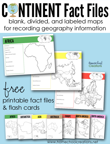
This year Kaleb and I have been wandering around the world via books, Little Passports, and various other things we come across in our travels. We have a slew of resources and to go along with a few of our books, I put together some printables where we could track important information related to the countries. 
continent-fact-files-printables-from-homeschool-creations_edited-1


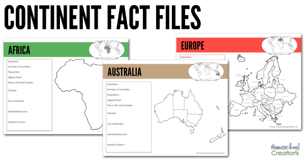
There are several pages for each continent: a blank continent image, one showing countries/territories within the continent, and another labeling each of the countries/territories within the continent (Antarctica only has one page). 

All continent fact pages were designed using the traditional Montessori colors: Africa (green), Antarctica (white), Asia (yellow), Australia (brown), Europe (red), North America (orange),  and South America (pink). 

Each page has room to record the following information and also shows where that continent is in comparison to other continents: 

  • Size/Area
  • Number of Countries
  • Population
  • Highest Point
  • Place with Most People
  • Climate
  • Top Landmarks
  • Natural Resources
  • Nearby Oceans

We’ve been using the below books to help us fill in the information blanks on each continent fact file: 


simple-continent-cards-from-homeschool-creations

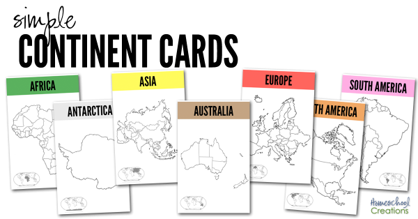
The set also has seven half-sheet printables we recommend printing off onto cardstock and laminating. Use them as larger flash cards to show the various country/territory divisions on the continents. We have a copy in each of our continent boxes and will put them on the wall above our map when we are studying the continent. 


We also highly recommend taking part in a Little Passports subscription! Not sure which adventure to choose for your explorer? Check out these Little Passports blog posts and learn more about their four subscription options:

Download the Continent Fact Files & Continent Cards

Your family is more than welcome to download the 23 page Continent Fact Files as well – and we hope they are a help to you!

 Download button


More Geography Resources


world flag cards for matching free homeschool geography resources 10 tools for teaching geography - hands on ways to incorporate geography learning

Click on one of the globe to search for geography resources by continent. Each page has downloads for flag coloring and information pages, mapping pages, and links to blog post full of lesson plans and additional information.


Africa   Asia   Australia
Europe    North America    South America


10 Tools for Teaching Geography & Exploring the World

10 tools for teaching geography - hands on ways to incorporate geography learning

We are barely finished with this school year, and over the last few weeks (ok, months) I’ve been piecing together what we will be doing during the upcoming school year. One of my initial plans for this past year was to work on world geography with the boys. Unfortunately, I went a little overboard in my mind and it was put to the side – mainly because I wanted to reinvent the wheel and put together a billion ideas (which were all good) into creating our own curriculum. 


Rather than running myself ragged – and truthfully in an effort to keep it more simple – I’ve decided to use something that is already pre-planned – Elementary Geography and Cultures from Masterbooks. It’s a curriculum I’ve been eyeing for quite some time (thanks to my friend Carisa) and includes the books Passport to the World and the Children’s Atlas of God’s World .  Yes, I will likely end up reworking some of my past geography printables and also create a few additional go-alongs for what we are doing, BUT I am so very excited about this one year world geography plan. 

Now, while having a curriculum framework to follow is great, the most effective way to teach our kids geography is through the hands-on tools that go along with ANY curriculum. Here are 10 tools for teaching geography – all things our family has used (and will use again) to keep learning fun.

10 Tools for Teaching Geography

10 tools for teaching geography and exploring the world

1 // Read Lots of Literature (and then some more)

One of the things we enjoyed the most our first geography go-round were the many books that are available based on the countries we studied. From missionaries that served in the country to picture books about artists or scientists, there is an amazing abundance of books to read and learn through. If you’d like to see the books we read through before, check out this page and click on the continent link to see favorites by country. 

2 // Play and Learn Music

Music can be one of the best tools to use for children to memorize things. Our girls used Geography Songs and we’ll use that again for learning countries, bodies of water, and continents.

Also spend time listening to composers who were born in the different countries or music that is native to the geographical areas. Take a trip to your library and check out a few CDs or have fun browsing YouTube to see traditional dances. 

3 // Create Art

Amazon Animal Chalk Pastel-17

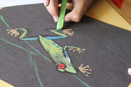
Learn about artists native to the country you are studying or special art styles that are based in a geographical region.  When we were studying the Amazon, we used chalk pastels to draw frogs, toucans, and other animals from the rainforest. They were some of our favorite drawings we’ve done! 

4 // Create Continent Boxes

Put aside and group all of the hands-on materials you collect into boxes (or bags) based on countries or continents. Over the years we’ve collected many fun things (some from our subscription to Little Passports) and also some new materials (I am absolutely in love with TOOBS and their animals and landmark figures). I’ve purchased seven photo storage boxes to keep all our materials in one spot. (Thanks to Counting Coconuts for the idea.)

5 // Learn about the Animals

Include a little science learning into each geographical area you study by looking at animals that are native to to that country. Our girls loved learning about kangaroos and koalas when we studies Australia, peacocks when we learned about India – and there are so many more. Learn about their habits, diet, and classification. We often created lapbooks and those stayed on our shelves to review for years to come.

6 // Eat and Cook a Special Meal Together


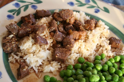
Cooking is not only a life skill for kids to learn, but it can be a memorable way to learn about a country. Depending on the country you are studying, pick a recipe or create a meal that would be native to that country (granted Antarctica might be a little hard…), but snow cones might be a favorite! Every now and then we would treat the kids to a special meal out if we had a great restaurant in town, because sometimes the cultural experience is equally (or even more) fun. If Pinterest is too overwhelming, the book Eat Your Way Around the World is full of recipes to try.


7 // Put a Puzzle Together

While you are reading out loud or keeping fidgeting kids busy, pull out a puzzle and work on it together. We have all of the GeoPuzzles and absolutely LOVE them. Rather than being regular shaped puzzle pieces, each piece is shaped like the countries within that continent. 

8 // Make Lego Creations

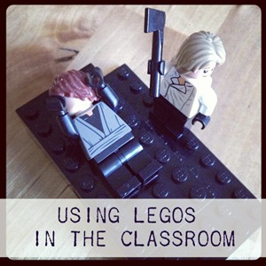
Using Legos in the Classroom

Legos may never leave our home. Our kids have a plethora of them, and we will definitely be incorporating them into our geography time filling out blank outline maps, building famous landmarks…or getting a good laugh in when the kids depict the most hilarious historical scenes with LEGOs. (Sometimes you just have to laugh even though beheading are no laughing matter.)

9 // Draw Through the Countries

Have a child that loves to draw? Pull out the Draw Write Now series and let your kids illustrate their way around the world. Use the Draw and Journal pages to draw a picture of an animal or landmark in that country and write down a few facts to go along. Our kids love to draw while I’m teaching – and it can help them remember facts better as well. Geography Through Art is another great book that includes art projects using different mediums – from all around the world.  

10 // Use Geography Printables

free geography resources

If you know me well, you’ll know that I love creating printables that help our kids in the learning process. Over the years we have used a variety of printables, both ones I’ve pulled together and ones from other blogging friends. Here are a few free geography resources


Those are a few of the ways we incorporate fun into our geography studies – how has your family expanded geography learning together? 


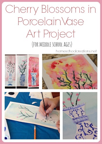
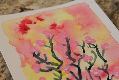
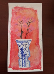
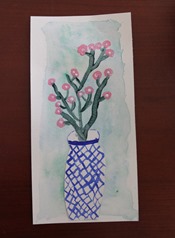
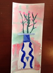
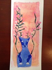
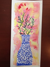
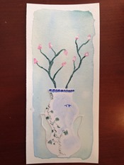
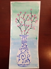
Cherry Blossoms in Porcelain Vase Art Project – Asian Theme Art Lesson

Last month our co-op spent some time learning about a few countries in Asia. As part of the lesson with the older group {grades 4 and up}, we worked on an art project tying in a few different themes: blue and white pottery from China and cherry blossoms from Japan. 

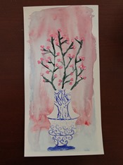
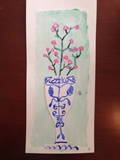
Cherry Blossom in Porcelain Vase art project from Homeschool Creations


After looking on Pinterest for some ideas {the vase from this one, the background from this one, and the color mixing on white/blue porcelain from here}, we merged a few projects together to put together a fun art project that the kids loved – and the results were FABULOUS! The kids learned some watercolor techniques, practiced mixing colors and shading, and experimented with several different mediums. Want to tag along on our project?

Supplies We Used:

Our time frame: 3 hours start to finish            


Grades: 4th – 8th

    Learning Watercolor Techniques

watercolor techniques

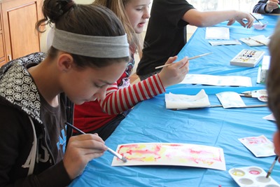
Our first part of the lesson was spent learning how to use watercolor Paper. We used liquid watercolors {these are different than cake watercolors, fyi}. We spent time talking about how to create the right shade of color we wanted {we used yellow, blue, green, and red for our choices}.

watercolor techniques

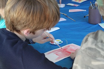
Each child had a piece of watercolor paper that was 1/3 of an 11”x14” piece of paper {watercolor paper is fairly pricey}. We practiced on some scraps before tackling the actual paper. The kids learned about the watercolor wash technique and that the watercolors will adhere to the parts of the papers that are wet.

watercolor techniques

If you look at the backgrounds on their projects, you’ll notice there is a white border. Part of the fun was leaving an area that wasn’t wet when they applied the watercolor wash. A few kids practiced the controlled wash, while a few others tried the open drip technique. {Much fun all around}.

Great video tutorial to learn a few basic watercolor techniques:

Watercolor techniques
    Learning About Blue and White Porcelain

While our watercolor backgrounds were drying, we had a short lesson on the history of blue and white porcelain and talked about the Willow Pattern story. While the Willow pattern isn’t from China, it was fun to talk about, especially to note some of the details in the pattern and how the pottery could tell a story.

Asia Art Lesson-19

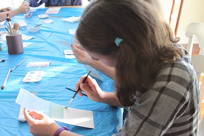
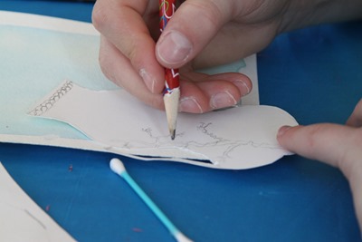
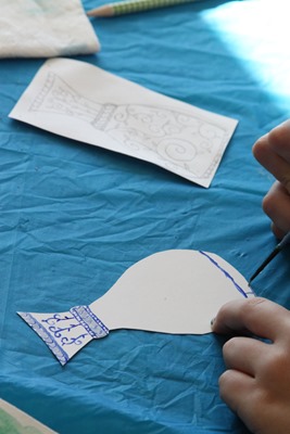
Once the history lesson was finished, each child sketched a vase design on their Bristol Paper. Although we asked the kids to attempt a simple design, several decided to work on a more intricate pattern. The kids cut out their vases and then designed a pattern for their vase.

Asia Art Lesson-9

We mixed together blue and white tempera paint to make six varying shades of paint. Using their choice of colors, they painted their vases following their patterns and set them aside to dry.

Couch Coop October - January-45

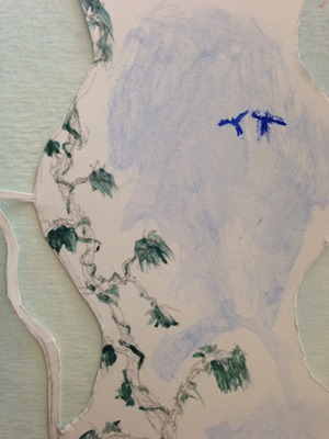
One of the boys in our group did such an amazing job on his design. He was pushed for time {and would have done so much more}, but his vase was the most intricate {notice those thin handles and remember this was a vase that is about 3” tall} and a well thought out design including the two birds from the Willow pattern story.

Adding Cherry Blossoms

Asia Art Lesson-16

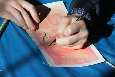
Once the vases were completed, we pulled out black tempera paint to paint branches coming out of our vases. The kids each placed their vases on their watercolor backgrounds to estimate where the branches would need to be shown coming out of the vase {each child had a different vase design and the vases were not yet adhered to the watercolor paper}.

Note: we were going to use India ink, but forgot to pick some up at the store. I would definitely recommend the ink vs. tempera for more of a ‘pop’ on the branches.

Asia Art Lesson-37

After the branches were in place, we used q-tips to dot pink and white tempera paint ‘cherry blossoms’ on the branches. Most of the kids did a grouping of pink dots with a single white dot center.

Once everything was dry, we used a double sided tape to adhere the vase to the watercolor paper, and we were done! Here’s a look at all the finished projects:

Asia Art Lesson-27boy, 4th grade Asia Art Lesson-32girl, 5th grade Couch Coop October - January-35boy, 5th grade
Couch Coop October - January-34boy, 6th grade Couch Coop October - January-36girl, 6th grade Couch Coop October - January-43
Couch Coop October - January-37girl, 7th grade Asia Art Lesson-42girl, 8th grade Couch Coop October - January-32boy, 8th grade

This honestly was one of my favorite lessons that we’ve done together with the co-op – and one of those that makes me excited to do more. Hope you enjoyed it too! Please feel free to leave any questions, because it is highly possible I forgot something! {grins}


Other Art Lessons for Children:

Helpful Links:

Country Flag Card Printables

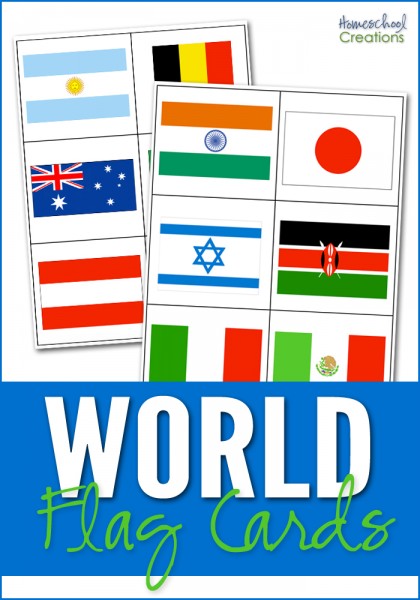
world flag cards for matching

I’ve been working on this printable for far.too.long, and FINALLY sat down this weekend, got productive and have it ready to share with you all! :) I put these together to help our kids identify the flags of the various countries we’ve been studying during our Galloping the Globe studies {with a few extra countries thrown in for good measure}.

There are 35 countries represented on the cards with two cards for each flag so it can be played as a ‘memory’ game. The set also contains 6 cards that represent 6 of the 7 continents {Antarctica is excluded} so the cards can also be sorted by the continent the country flag belongs to. Country name cards are also included for your child to match the names of the countries with the appropriate flag.

Since I don’t know every flag and what country it belongs to *ahem*, I included a key at the end of the document to help you all double check your answers. :)


I hope that a few of these resources help you all out ~ let me know if you all have any questions or have problems with the download.

Traveling Russia: Week 2

After our first week studying Russia, I found even more to study the next week. There are times when the resources seem to be overwhelming, especially when you find them on the tail end of your studies.

Both of our girls love to pretend to be ballerinas, so this week we spent some time listening to famous Russian composers and watching some ballet in action. Needless to say, there have been lots of tights flying, tutus twirling and spinning like crazy. Zachary included. :)

Monday

  • Quick review from previous week’s studies
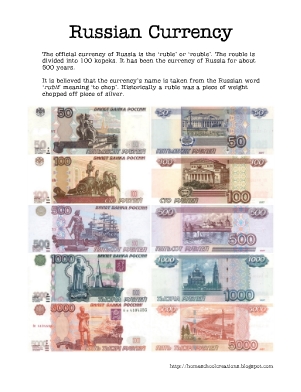
  • Look at the currency of Russia (see notebooking page I made below)
  • Review geography song (from Geography Songs cd)
  • Pick a meal to make and put grocery list together
  • Watch a little of Fiddler on the Roof (since this takes place in Russia)

Tuesday

  • Sing geography song and point to countries on map
  • Talk about some of the geographical/climate features of Russia and do map activities: Ural mountains (divide Russia between Europe and Asia); coldest inhabited place on Earth is Verkhoyansk; dry climate and poor soil; Volga River is longest river in Europe, three of longest rivers in world are in Russia (Ob, Yenisei, and Lena); Lake Baikal is deepest, largest fresh water lake in the world; three differenet land areas: tundra, taiga, and steppe
  • Listen to Tchaikovsky and have fun dancing

Wednesday

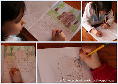
  • Use Draw Write Now to draw picture of a brown bear and also copywork about bear
  • Talk about some of the different animals in Russia
  • Review geography song
  • Talk about the history of Russia using notebooking pages
  • Watch a little bit of Nutcracker

Thursday

  • Sing geography song and point to countries without using cd
  • Talk about religion in Russia and what happened during Communist rule (atheism). You can read about Laurianna and McKenna’s reaction to atheism on our family blog – too funny.
  • Compare Russian alphabet to our alphabet
  • Work on making meal (Beef stroganoff)
  • Stamp passports

Websites that we visited:

  • National Geographic Kids – facts and pictures about Russia
  • Enchanted Learning about Russia – members only
  • Travel for Kids – fun things to do with kids in Russia. Also includes book ideas for helping kids learn about Russia
  • Time for Kids – learn more about Russia’s culture, landscape and resources
  • Mission Friends – resource available from the Lutheran Church. This is the student pdf version that you can print off and use as a great resource for you teaching of Russia. It includes the map activity that we did and a lot of wonderful information. Our kids really enjoyed this!
  • Nutcracker on youtube – this is the first of 16 mini-videos of the Nutcracker performed at the Royal Opera House. The girls loved this!

The currency notebooking sheet that I put together on the ruble: Next week we are going to be moving our studies to England/Great Britain, so stay tuned for more!

Resources that we used:


Jolanthe Signature affiliate button

Traveling Russia: Week 1

This last week we started our study of Russia with the girls. I haven’t had a chance to sit down and pull all my thoughts together until now, so I might miss some stuff that we did because there have been moments when we have veered off course from my plans and I keep forgetting to pencil in what we actually did {sigh}.

That said, I can give you a basic framework of what our week looked like, include some links that we/I used, the books we used, and one of the worksheets that I pulled together for us. I’m also working on putting a post together that talks about some of the specific things that I try to do for each country that we study (and might go into a little more detail in this post too about how we did some of the things to give you an idea).

Monday

  • Locate and map Russia. We have a wall map and globe that we use for this. The girls find the country on the map and we talk about a few different things: what continent the country is on, which hemispheres, what other countries it is near, etc…
  • Introduce our new geography song. I can’t say enough about how much we have enjoyed the cd Geography Songs and how much the girls (and Zachary by default) have learned from this cd. This week we learned the song "Former USSR". As we sing the song, we find the other countries that are mentioned in the song and work on remembering where the countries are and pointing them as we sing along.
  • Use our atlas to learn more about Russia. We use The Children’s World Atlas from Rand McNally. We read the little blurbs in the book on industry and other key facts about the country: population, major cities, etc…
  • Find the capital of the country

Tuesday

  • Read Children Just Like Me and complete the worksheet. I made a worksheet to go along with the book, so after we read about the child from the country we are studying, we fill in the information we learned (what city, religion, language, favorite foods, etc…)
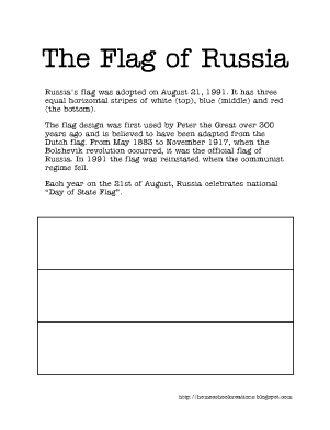
  • Learn about Russia’s flag. This week I made up a little worksheet about the flag of Russia (you can print it off below).
  • Review our geography song
  • Talk about some interesting facts about Russia: it is on two different continents (found dividing point), 11 different time zones, takes up almost all of Eastern hemisphere

Wednesday

  • Review our geography song with map.
  • Play a Russian game
  • Travel and learn a little about Russia via a website – a virtual tour

Thursday

  • Review our geography song
  • Learn about the language(s) spoken in Russia and different religions. We also used this time to talk about the time that Russia was under Communist rule and people weren’t allowed to believe in God.

Here are some of the books that we used this week in our studies:

Some great websites and links related to Russia:

This is the worksheet I put together on the Russian flag:

Next week we will be continuing our time in Russia and learning about the currency of Russia, making a meal, studying the different geography features of Russia and the climate and more so be sure to check back or look for the second link/post.

Jolanthe Signature affiliate button