20 Best Tips

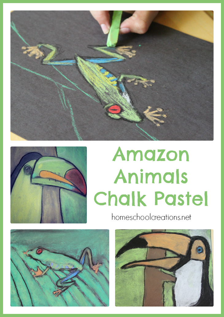
Amazon Animals Chalk Pastel

Last year you may remember me sharing a few of the chalk pastel projects that we worked on thanks to Tricia at HodgePodge. This year, for one of our co-op projects, I somehow managed to sign myself up for the Amazon region art spot with the older group of kids.
Amazon Animals Chalk Pastel

Relying on all the fun we had last year with the chalk pastels and knowing how forgiving they can be, we pulled together a fun Amazon Animals Chalk Pastel project for the kids using a few basic supplies {see a version of this project at Deep Space Sparkle}.

  • 9×12 black paper {we used construction paper because it’s what we had handy, but in the future I would use something different}
  • Chalk Pastels
  • Oil Pastels {to outline}
  • And LOTS of baby wipes. Lots, people.

Amazon Animal Chalk Pastel-10

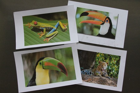
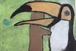
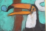
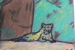
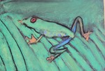
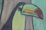
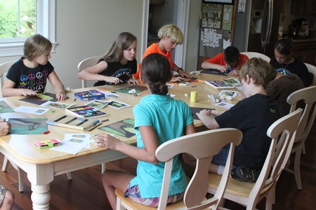
Each of the children {ages 8 to 13} chose a picture of a frog, bird, or animal that had been printed out prior to the class {I printed out a few pictures via a Google image search}.
Amazon Animal Chalk Pastel-14

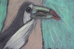
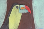
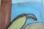
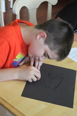
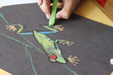
They lightly sketched their version of the image onto their paper using a black oil pastel and then colored it in with the chalk pastels.
Amazon Animal Chalk Pastel-19

Once the chalk pastels had been smudged, outlines of the picture were retraced to make it ‘pop’.
Amazon Animal Chalk Pastel-17

The kids all had a blast creating their projects and we think they turned out great!
Amazon Animal Chalk Pastel Amazon Animal Chalk Pastel-3 Amazon Animal Chalk Pastel-4
Amazon Animal Chalk Pastel-5 Amazon Animal Chalk Pastel-6 Amazon Animal Chalk Pastel-7
Amazon Animal Chalk Pastel-8 Amazon Animal Chalk Pastel-9 Amazon Animal Chalk Pastel-2


Resources for Chalk Pastel Art

Here are a few projects we’ve worked on using chalk pastels and also a few resources in case you would like to work on one with your family:

Fall Art Tutorials Seasonal Chalk Pastel Bundle


Niger Geography Printables and Unit Study Links

RAV-468X60-BannerAds

In support of the Raise a Village campaign, I am part of a team of homeschool educators  partnering with Samaritan’s Purse to bring you part of an educational unit study of Niger.
Today I have a few printables to share with you based on the country of Niger {not Nigeria – did you know there were two countries in Africa with such similar names?}. If you are working on a geography unit for Africa, these printables will be a fun addition to your learning. Don’t forget to check below too. There are links to several other helpful printables, art projects, and lesson plans from other homeschool moms to help you out as well.

Niger Mapping Page, Country Factsheet, and Prayer Printables

Niger Geography Pages via HomeschoolCreations


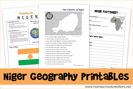
The Niger Geography Printables include the following worksheets:

  • a mapping sheet for the country of Niger {map rivers, countries, mountains, and other geographical information}
  • a country factsheet to write down information about Niger including when it became a country, current population, climate, type of government, and more
  • a prayer sheet to display and use when studying about Niger

You can find out specific information on the country of Niger that will help you fill out the worksheets by visiting this site and also the Raise a Village page from Samaritan’s Purse.


Don’t miss these FREE geography printables listed by continent…

image image image image image image


Additional Printables, Projects, and Ideas for a Niger Unit Study

Visit the following blogs for more free printables and unit study ideas to use with your family when learning about the country of Niger:

Raise a Village from Samaritan’s Purse

RAV-300x250-BannerAd

You can find out how Samaritan’s Purse is partnering with Guidan Gado, a village in the country of Niger where families struggle in hopeless situations.

Raise a Village is an effort to change lives by supplying livestock, seeds, tools, and other aid that will provide the 1,400 people living in Guidan Gado with a hope-filled future. It is just one of the many ways we are working in Niger, which is one of the poorest countries on earth.

Follow the progress of Raise a Village.


I volunteered to create printables and share information about Raise a Village from Samaritan’s Purse. I was not compensated in any form and all thoughts, printables, and such are my very own.

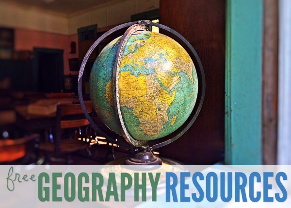
Free Homeschool Geography Resources

free homeschool geography resources

If you are looking for free geography printables to go along with your homeschool studies, below you’ll find several notebooking pages you can use in your home. 

Click on one of the globe to search for geography resources by continent. Each page has downloads for flag coloring and information pages, mapping pages and links to blog post full of lesson plans and additional information.

Africa   Asia   Australia
Europe    North America    South America
 

free geography resources

Here’s a quick look at a few more free geography printables to help you out.

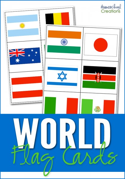
world flag cards for matching

World Flag Cards ~ The world flag cards represent 35 countries based on the countries that are studied in Galloping the Globe {with a few extras thrown in}. The set also contains 6 cards that represent 6 of the 7 continents {Antarctica is excluded} so cards can also be sorted by the continent the country flag belongs to. Country name cards are also included for your child to match the names of the countries with the appropriate flag. Also includes a key at the end of the document to help double check your answers.

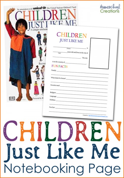
Children Just Like Me notebooking page

Children Just Like Me Notebooking Page ~ This notebooking page was created to go along with the book Children Just Like Me. Your child collects all the information for the notebooking sheet from the children’s stories in the book. You can read more about the page here.

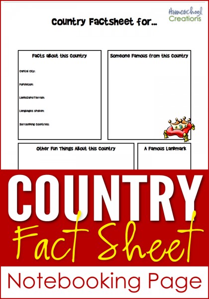
country fact sheet notebooking page for geography studies

Country Fact Notebooking Page ~ This notebooking sheet can be used for any country. There is room to record information about the country: country facts, famous people, landmark(s), and other fun information. Also room to draw pictures, add clip art and journal. You can see an example here.

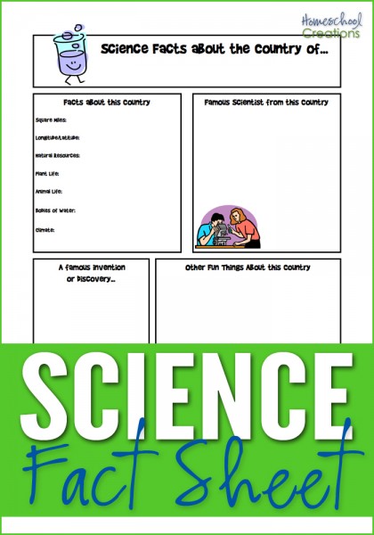
science fact notebooking sheet for geography studies

Science Fact Notebooking Page ~ Similar in layout to the Country Fact Notebooking Page, this has room for famous inventors and inventions, science facts about the country, plant and animal life, etc…

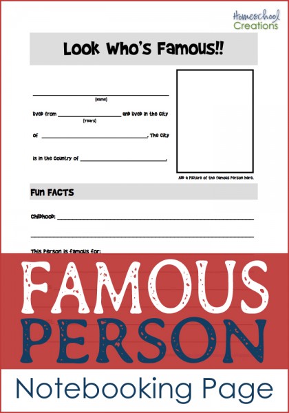
famous person notebooking page

Famous Person Notebooking Page ~ Have a famous person that lived in the country you are studying? This is a notebooking sheet records information about that person: where s/he lived, hobbies, childhood, and what they are famous for. There’s even a little space to add a picture if you’d like.

country geography notebooking page

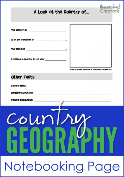
Country Geography Notebooking Page ~ Jot down some notes on the country you are studying: square miles, longitude/latitude, natural resources, religions, languages and more. It also has space to add a picture of the country you are learning more about.

And if you’re looking for more geography fun, you can take a virtual adventure with Little Passports ~ all you have to do is walk to your mailbox to start. :)


Hope that a few of these resources help you all out!

Little Passports on Sale until July 31st!


Looking for a fun way to include world geography in your day? Little Passports is a company that takes your children on a global adventure ~ starting right at your own mailbox!

Our kids had much fun with the kits several years ago when we were in the midst of our world geography studies {you can read my review of Little Passports here}. Each month a new country is introduced to your children through a fun interactive kit they receive in the mail. 

image

From now until the end of July, you can take 10% off your order when you use the code SHARE10. All you have to do is visit their site and use the code during checkout!!

Just wanted to pass along the sale to you all! :)

Jolanthe Signature affiliate button

World and US Wall Clings!!

IMG_8203

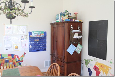
Our new ‘schoolroom’ has a lot more wall space ~ and white wall space at that. I found some GREAT wall clings to hang up in our school area and reinforce a little geography at the same time! The World and United State map wall clings were at our local Target in the bedding aisles {on an end cap} and we LOVE them.

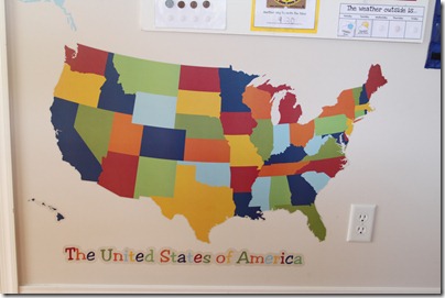
They’ve added a splash of color to our room and have a ton of clings in addition to the ones that I have hanging up already. The United States of America cling also has the names of each individual state as clings that kids can place on the map.

IMG_8304

There are a bunch of animal clings also so you can put them all around the world. Countries and oceans have clings that can be placed on the wall {with the exception of Europe}. I have a feeling that the missing Europe was unintentional, since there were supposed to be 164 wall clings and there is a sticker over the number 4, making it a 3. :) On the bright side, the kids noticed that it was missing!

IMG_8306

The set was just under $20 at Target. You can also purchase the set via Amazon if your local Target doesn’t carry it!

Jolanthe Signature affiliate button

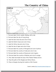
Mapping China Printable

When I first started doing our geography studies, I didn’t know how many people I would eventually be sharing my files with. For the first few countries we studied in Asia, there were no mapping projects created to go along with them.

Several of you have emailed me asking if I either had them available or could pull them together. I’m slowly working through them {and will be posting Israel, Russia, and Korea soon!}, but posted a map notebooking page for China in case you all are interested! Just click on the thumbnail image below to download a copy.

Mapping China

The rest of my printables for the continent of Asia, including the country of China, can be found on my Asia Notebooking Printables page.

Here’s a quick peek at some of the other FREE geography lesson plans and geography printables that I have created:

Jolanthe Signature affiliate button